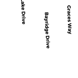
153 BAY RIDGE DRIVE SD
Owner Information
PAPALIA DONNA M
10 LALLI DRIVE
KATONAH, NY 10536


Property Details
153 BAY RIDGE DRIVE SD is classified as a Single Family Residential (Ranch).
The primary structure on this property was built in 1959. There are 828ft2 of built area within this property. There is 828ft2 of residential/living space within this property. This property is listed as having 5 rooms.
153 BAY RIDGE DRIVE SD is valued at $289,000. The land is valued at $113,800 and the structures are valued at $175,200.
The most recent deed for 153 BAY RIDGE DRIVE SD is recorded at the local registrar in Book 27003, Page 216. 153 BAY RIDGE DRIVE SD was last sold on Monday, December 31, 2012 for $0.
Assessment data from fiscal year 2022.
Flood Data
According to the FEMA National Flood Hazard Layer, this property does not appear to be in a flood zone. It may also be in an area not yet reviewed. Nonetheless, confirm this information prior to taking any action.
To view the flood hazards around this property, create a FEMA "Firmette" Map of the area around 153 BAY RIDGE DRIVE SD.
Broadband Internet Providers
| Provider | Type | Bandwidth (mbps) | |
|---|---|---|---|
| VSAT Systems, LLC. | Satellite | 2 | 1 |
| Viasat Inc | Satellite | 35 | 3 |
| Verizon New England Inc. | DSL | 5 | 0 |
| Comcast | Cable | 1000 | 35 |
| GCI Communication Corp. | Satellite | 0 | 0 |
| HughesNet | Satellite | 25 | 3 |
Broadband service provider data from December 2020.
Adjacent Properties
- 157 BAY RIDGE DRIVE SD
Housing Authority owned by DENNIS HOUSING AUTHORITY - 23 BAY RIDGE DRIVE SD
Single Family Residential owned by SULLIVAN AVA LEE TRUSTEE - 4 LAKE DRIVE SD
Single Family Residential owned by FERRON CHRISTOPHER JOHN ET AL - 10 LAKE DRIVE SD
Single Family Residential owned by SMITH EDGAR J JR - 149 BAY RIDGE DRIVE SD
Undevelopable Residential Land owned by SMITH EDGAR J JR